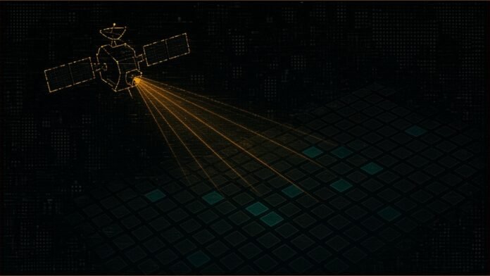
NASA and the US Department of Agriculture (USDA) have signed an agreement to bring NASA’s satellite data, models and computing know-how into the statistics the USDA uses to estimate what American farms will grow.
NASA Administrator Jared Isaacman and Agriculture Secretary Brooke Rollins signed the memorandum of understanding (MOU) on 24 October at the University of Alabama in Tuscaloosa, during what NASA calls its Inspiration Tour. According to NASA’s release, the deal expands cooperation in Earth observation, geospatial analytics and data technologies to support the USDA’s data modernisation plan. The goal, both agencies say, is better crop monitoring, acreage and yield estimates, and assessments of drought and other disasters.
In brief
- NASA and the USDA have signed an MOU to bring NASA Earth observation data and analysis into US agricultural statistics.
- The USDA lists three areas of work: aligning missions with its data needs, data access and infrastructure, and joint review of crop and yield methods.
- Neither agency has published a budget, a timeline or a first product.
The USDA sets out three areas of cooperation
The USDA’s release is more specific than NASA’s. It says the scope “may include, but is not limited to, agricultural statistics, remote sensing science, modeling, geospatial data engineering, and super intelligence/machine learning”. It then names three areas of cooperation:
- Mission and data alignment: regular technical exchanges to match USDA statistical needs with NASA Earth science missions and data products, such as satellite observations and model outputs.
- Data access and infrastructure: talks on giving the USDA scalable access to NASA archives through cloud-native geospatial formats, application programming interfaces (APIs) and workflow tools that can feed the USDA’s production systems.
- Methods and validation: joint technical reviews of the algorithms behind crop condition indicators, yield models, planted and harvested area estimates and disaster impact assessments, including bias correction, uncertainty and checks against ground data.
The USDA says the list is not exhaustive and other areas may be added as priorities change. It ties the MOU to its Data Modernization Plan, launched last month, which it says aims to “reduce unnecessary burdens on producers” and make farm data more timely and accurate. The USDA also links the work to Executive Order 14369, “Ensuring American Space Superiority”, issued in December 2025.
What the two leaders said
“By combining NASA’s Earth observation data and technical expertise with USDA’s knowledge of American agriculture, we can improve the information available to farmers and ranchers, strengthen our understanding of crop conditions and natural hazards, and pursue new high-risk, high-reward ideas,” Isaacman said in both releases.
“American farmers are the best in the world and deserve any solution we can leverage, even when it is out of this world,” Rollins said. She said the partnership will “enhance USDA acreage and yield estimation and drive profitability for American agriculture.”
At the signing, Rollins told the University of Alabama’s student newspaper, The Crimson White, that the MOU would allow “regular technical exchanges, greater access to NASA data and technical reviews of using NASA data for field modeling and acreage estimation”. The event was held before the Alabama-Texas A&M American football game.
Better crop numbers would reach every farmer, if the work follows
The idea is sound and the payoff could be wide. The USDA describes its statistics as the data that “inform decisions across American agriculture”, so more timely and accurate acreage and yield figures would reach farmers who never see a satellite image. The three areas the USDA lists are also the right ones: data that is easy to reach, models that are checked against the ground, and missions matched to what statisticians need.
But an MOU is a promise to talk, not a programme. NASA’s own release says the agencies “can explore” these activities. Neither agency has named a budget, staff, a timeline or a first product, and USDA’s mention of “super intelligence” is not explained. TSN has made a similar point about other Earth-data tools, from Mila and NRCan’s AI wildfire hazard maps to ICEYE and OroraTech’s wildfire satellites and Vaisala’s AI lightning forecasts: the test is published results from real use.
For this agreement, that means a USDA crop or yield report that says it used NASA data or methods agreed under the MOU, and shows how the estimate changed. More public-benefit technology appears in TSN’s Tech for Good weekly round-up.
Sources
- NASA, “NASA, USDA Sign Agreement Advancing Earth Science, Agriculture”, release 26-090, 26 October 2026
- USDA, “Secretary Rollins and NASA Administrator Isaacman Sign MOU to Advance USDA Data Modernization Plan”, 24 October 2026 (also issued as a USDA email bulletin)
- The Crimson White, “NASA, Agriculture leaders sign Memorandum of Understanding, lead flyover”, 25 October 2026
Related stories
- Mila and NRCan AI Maps Wildfire Hazard Hundreds of Times Faster
- ICEYE and OroraTech Pair Radar and Thermal Satellites on Wildfires
- Tech for Good This Week: AI Diagnosis, Cleaner Grids and Scam Busts
Follow @tsnmediahub on X for breaking AI news as it happens.
Follow on X